Development Survey

A successful project always begins with a successful survey.

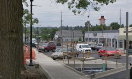
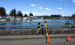
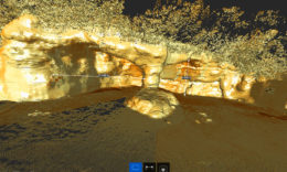
Westlake has completed thousands of land surveys throughout Oregon and the United States. Our surveyors combine expertise with a high level of collaborative and responsive service to satisfy the needs of developers and public agencies. Our survey team uses state-of-the-art geospatial technologies, GPS/GNSS, AutoCAD, and specialized 3D scanning / measurement services. We work with our clients to select the best technology for the survey project requirements, site conditions and project timing.

We Offer:

  • Topographic & Existing Conditions Mapping
  • Boundary Surveying / Record of Survey
  • ALTA/NSPS Surveys
  • Subdivision Platting
  • Land Partitions & Property Line Adjustments
  • Elevation Certificates
  • Construction Surveying (see our Services page)

Project Services

  • Site Development Services – We work closely with planners and engineers—both in-house, and from other firms—to ensure that site development surveying meets all jurisdictional codes and requirements.
  • Roadways and Infrastructure – We provide thorough research, surveying, and field location for right-of-way resolution and acquisition for large public works projects. We understand that proper mapping of existing improvements within right-of-way and property lines is critical to the design team.
  • Boundary and Design Topographic Surveys – Strict attention to detail allows us to assist design teams in better understanding site topography for evaluation, planning and design.
  • ALTA/NSPS Land Title Surveys – Westlake has earned a reputation as a reliable, trusted source for ALTA and land title surveying. We maintain an extensive database of our previously completed ALTA surveys which can help us assist clients quickly, and at a reduced cost.
  • Utility Surveys – Utility surveying can present unique challenges, including varied ownership of property, or remote and demanding terrain. We unite a thorough understanding of the design criteria, comprehensive planning, and consistent quality control to serve the public agencies, owners and engineers we work with.

FAQs

  1. Why do I need a licensed professional land surveyor? Only a licensed surveyor can provide a legal land survey, or create or modify land boundaries and easements. Professional surveyors must be licensed through the state a property is located in. Surveyors in Oregon are licensed through the Oregon State Board of Examiners for Engineering and Land Surveying (OSBEELS)
  2. What is Oregon Right of Entry (ROE)?  In Oregon, surveyors may enter private land if they attempt to contact the owner or occupant beforehand. Read more about Right of Entry (672.047) on the State of Oregon ROE website for more information.


Client Testimonial

We were impressed by the quality of work and the deliverable schedule. Please pass on my appreciation to the project team. If you need a reference for future projects, I would be glad to give your firm one.”

John Gillespie, PE, AECOM

Contact Us

15115 SW Sequoia Parkway, Suite 150
Tigard, OR 97224

503.684.0652

info@westlakeconsultants.com