Begin with the end in mind.
SINCE 1983.
Begin with the end in mind.
SINCE 1983.
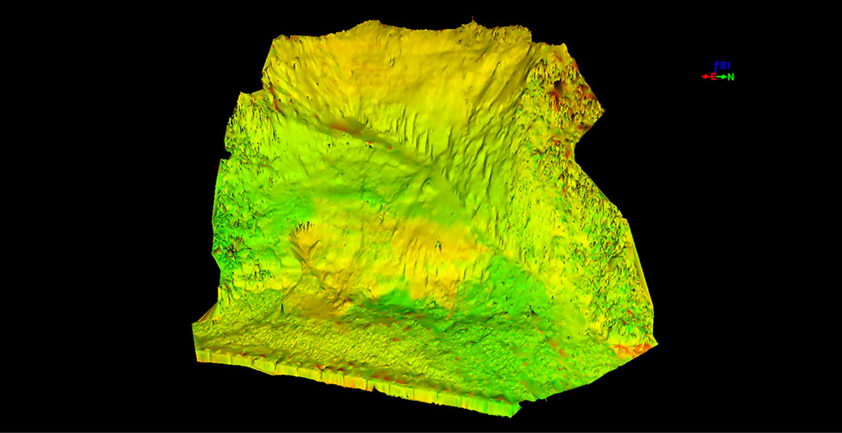
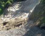
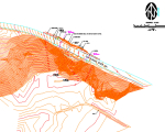
3D laser scanning answered the challenge of capturing data for a landslide on Clackamas River Drive in Clackamas County, Oregon. 3D scanning captures coordinate data for every visible surface in challenging and dangerous environments. The County had cleared material from the road surface, but needed survey data for remediation design. Ground surveying was impractical because of the unstable and dangerous slope extending approximately 300’ along the roadway to a height of nearly 400‘. The narrow roadway is located directly above the Clackamas River which further limited options for setting up survey equipment. The scan data were overlaid on a traditional topographic map to provide enough detail for Clackamas County geotechnical engineers to create a remediation plan.
It was a very professional experience working with the team from Westlake Consultants. Our seventeen story mid-rise was no match for their talent and experience. Very detailed and knowledgeable. I highly recommend taking advantage of their services.”