Begin with the end in mind.
SINCE 1983.

The rapid evolution of 3D laser scanning technology is revealing many new and previously unimaginable applications. For instance, the ability to scan and model for as-built data for building reconstruction and layout is now widely accepted as a beneficial, if not necessary, aspect of the construction process. One of scanning’s more recent and exciting applications is the ability to document, preserve, and even transform our view of the past.
In the United States there are only ninety locations designated as National Historic Sites. To have one practically in your backyard is exceptional, and offers unique scanning opportunities.
Fort Vancouver is one of the most important and dynamic historical sites in the Pacific Northwest. Due to its strategic location on the Columbia River in Southwest Washington State, it began as a vital trade center for the British Hudson Bay Company. Later, it would serve as a U.S. Army post to aid settlers, and would remain an active post for more than 150 years. Into the 20th Century, the site was the location of the world’s largest spruce mill during World War I, and then the home of the Kaiser Shipyards during World War II. Pearson Field, the adjoining airfield, had the distinction of being the landing site for the first nonstop flight over the North Pole.
Besides the Fort proper, the site contains “Officers Row”; over twenty fully-restored officer homes from the nineteenth century. These beautiful homes are perfect subjects for 3D documentation, and laser scanning has increasingly become the ideal way to capture large amounts of information for use in historical preservation.
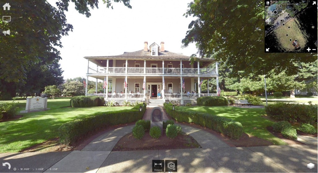
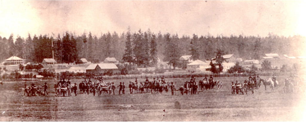
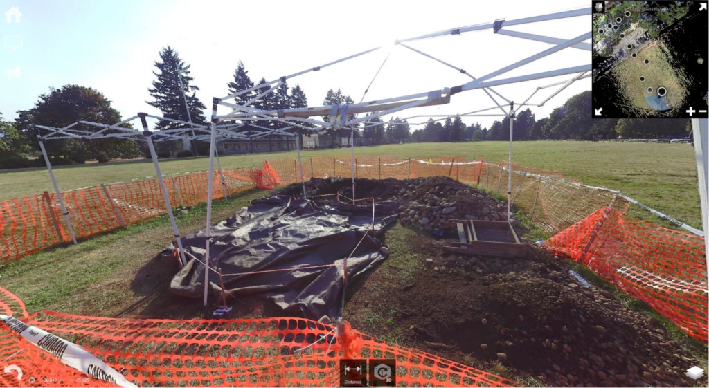
One of the stand-outs along this Row is the General Ulysses S. Grant House (pictured at the top of this blog post). Westlake Consultants recently provided volunteer scanning of the exterior of the Grant House, which also can be seen in the archive photo below (Grant House is at the far left edge). As a bonus, the Washington State Dept. of Archaeology was excavating on the adjacent parade grounds at the same time Westlake’s volunteer was on site. The archaeologist was searching for the army post’s flag staff located there in the mid-1800’s. The pole can be seen on the left hand side of the archival photo.

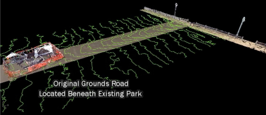
The original parade grounds had a road running through the middle, and around the flag staff base. The archaeologist believed that they had found the road from a slight hump in the ground. Standing on the site, this mound was very difficult to see, due to a century and a half of wear and tear. Our volunteer offered to scan the field around the excavation to get an aerial 3D view; verifying that the road did in fact run through the dig site. A FARO 330 laser scanner with photos, and target-less registration was used.

A topographic survey was created from the scan data, and the results revealed the road running through the excavation, as seen below in this computer screen shot.

Laser scanning will continue to grow as an integral component of conservation and archaeology. It is very exciting to be part of this innovation in documenting and preserving history.
Equipment: FARO Scanners
Software: ReCap – registration
Cloud Compare – Data post processing
Rhino 5 – Modeling and visualizations
I wanted to compliment you on your cad files. These files were the cleanest I have worked with in a long time. I see a lot of files from Engineers (200+ jobs a year) and your files were very nice to work with. I appreciate an engineering firm that takes the time to pay attention to their product.”